Hub & Spoke
There may be sexier-sounding travel destinations — Istanbul? Cinque Terre? — but few can boast Kanab's outdoor access and return on investment.
Cicindela albissima, with its tan wings and white fuzz covering its iridescent bronze-green body, is a bright spot of life in a vast, forbidding land. The hardy little arthropod is commonly called the Coral Pink Sand Dunes tiger beetle because it doesn’t live anywhere else. From a distance, it hardly stands out from the endless sandcastles it calls home, but zoom in and you see something rare, striking and decidedly local.
It’s a lot like the place it calls home in that regard.
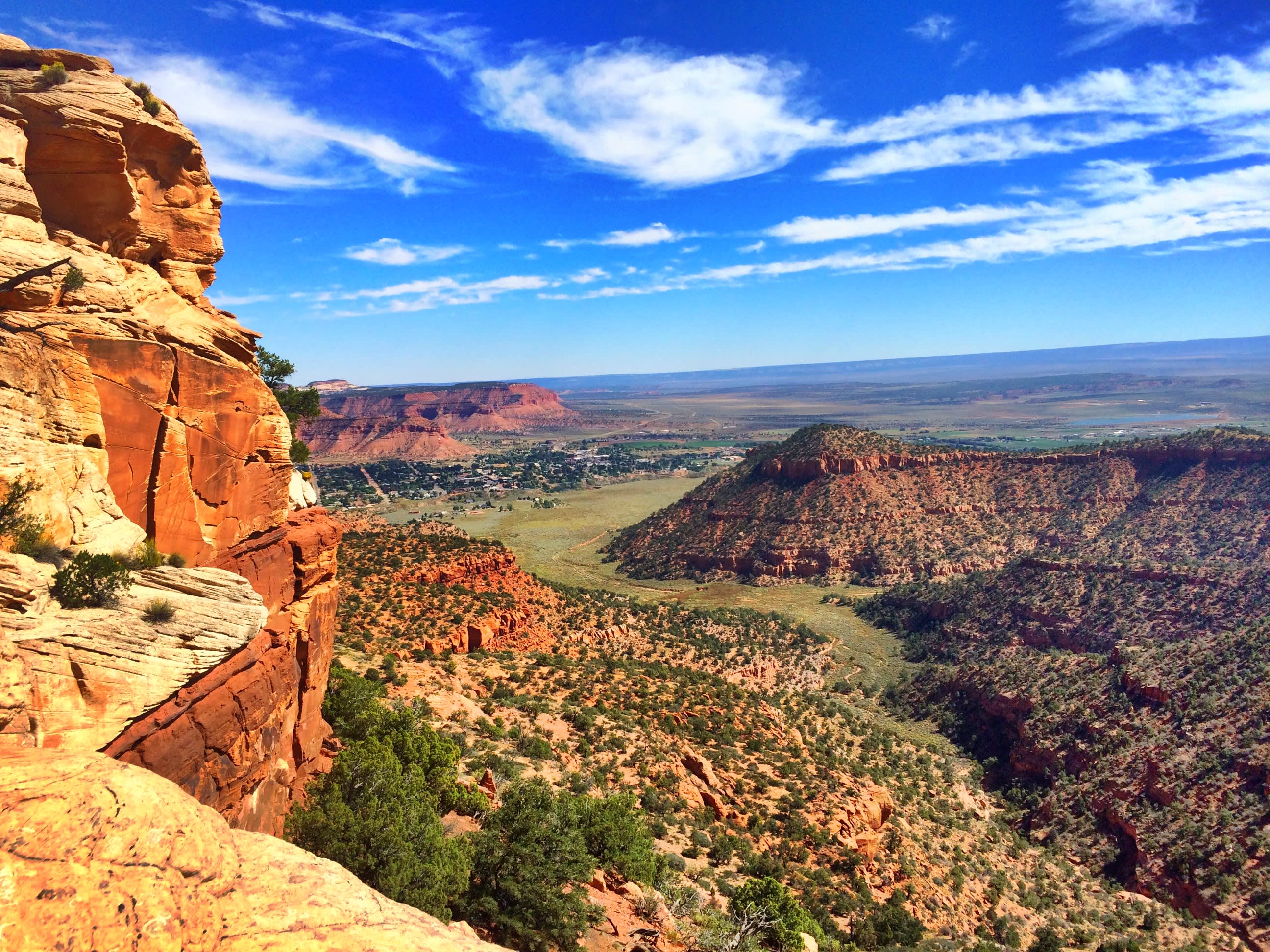
Kanab — homebase for those visiting Coral Pink Sand Dunes and so much else — is similarly beautiful, similarly under appreciated. Quietly holding down the middle of Utah’s southern border, Kanab accesses Lake Powell, Dixie National Forest, Kodachrome Basin, Grand Staircase, Zion and Bryce, Paria and Grand Canyons.
From Kanab (pop. 4,468), you’re no more than two hours from 10 of America’s best natural attractions. Just like the tiger beetle, which lives its life in a 1,000-foot radius, you won’t have to travel far to enjoy off-roading, hiking, hunting, fishing, canyoneering or horseback riding.
Got the travel bug? Check out Kanab, an unassuming little spot with secret life. But remember: You’re a visitor in someone else’s home. Tour widely but tread lightly.
Enough about the hub; here’s a little info on our 5 favorite spokes (day trips):
Grand Canyon North Rim → 78 Miles South
The North Rim is more remote and less developed than the South Rim, so it attracts far fewer tourists (yes!). Many people think the views from the higher north side are most spectacular. We’ll let you be the judge.
Grand Canyon
Local tip:
Stop at Jacob Lake Inn for some of their famous baked goods. You’ll hike off the calories.
Directions from Kanab
1. Take US-89A south to Jacob Lake. (36 miles)
2. Turn right on AZ-67 and head south to North Rim. (42 miles)
Bryce Canyon → 76 Miles North
Discover Utah’s tallest park, where you can see the world’s largest concentration of hoodoos — strange limestone sentinels that stand by the thousands in a flaming panorama of reds, yellows, pinks and oranges. (See them ASAP: These eccentric obelisks naturally erode 1/2 inch per year!)
Bryce Canyon
Local tip:
Stop at Bryce Canyon Pines for pie. We recommend the strawberry banana cream. The sour cream raisin is a more adventurous choice.
Directions from Kanab
1. Take US-89 north to UT-12. (60 miles)
2. Take UT-12 east to UT-63. (13 miles)
3. Take UT-63 south to the park entrance. (3 miles)
Zion National Park → 30 Miles Northwest
Powerful attractions. Zero distractions. It may be Utah’s most visited national park, but there’s a reason. And, since you’re coming from Kanab, you can hang out on the less crowded east side.
Zion National Park
Local tip:
Make sure to stop at one of several pull outs just east of the tunnel so you can explore Checkerboard Mesa.
Directions from Kanab
1. Take US-89 north to Mt Carmel Junction and turn left onto UT-9. (16.5 miles)
2. Take UT-9 northwest to the east entrance of the park. (13 miles)
Coral Pink Sand Dunes → 20 Miles Southwest
Wind + Navajo sandstone + Venturi effect = two miles of rolling pink sand waves. Bring your motorcycles, ATVs, kids and/or skis.
Coral Pink Sand Dunes
Local tip:
Stop in at Best Friends Animal Sanctuary on your way and take the free tour. Warning: you may leave with an adorable pet.
Directions from Kanab
1. Take US-89 north to Hancock Rd and turn left. (7.2 miles)
2. Take Hancock Rd southwest to UT-43/Coral Pink Sand Dunes Rd and turn left. (9.4 miles)
3. Take UT-43/Coral Pink Sand Dunes Road south to the park. (3.2 miles)
Coyote Buttes: The Wave → 49 Miles East
People line up to enter a drawing to maybe have a chance to win a permit to hike the multilayered curvilinear Wave formation just across the Arizona border. It’s that cool.
Coyote Buttes: The Wave
Local tip:
Check in with the Kanab Visitor Center before you head out. Nice, knowledgeable folks who’ll provide info to make your trip worthwhile. 745 E Highway 89 in Kanab.
Directions from Kanab to the Wave
1. Take US-89 east and turn right onto House Rock Valley Rd. (38.3 miles)
2. Take House Rock Valley Rd south to the trailhead. (8.4 miles)
Or, if you never win drawings, or you’re bad at planning ahead, or you just don’t want a dozen people in your engagement photos, the White Pocket area east of the Wave is just as swirly with a fraction of the traffic. Getting there takes some effort, though.
Directions from Kanab to White Pocket
1. Take US-89 east and turn right onto House Rock Valley Rd. (38.3 miles)
2. Take House Rock Valley Rd/House Rock Rd south Pine Tree Rd and turn left. (20.1 miles)
3. Take Pine Tree Rd and turn left at the fork near a farm. (6.1 miles)
4. Take the unnamed road northeast. (3.9 miles)
5. Take the left fork to continue north-northeast to the trailhead. (5.3 miles)
There's a lot of other awesome stuff to do in Kanab. Click here to start planning your trip.