3 Sites That Make the San Rafael Swell
The playground in Utah's arid core is open.
Find a bottomless basket of rides, climbs, camps, hikes and paddles in Utah’s San Rafael Swell, one of the most uplifting geological uplifts in the world. There are no crowds and no lines, but there are some tough decisions — like what to do first.
In The Swell, located just east of Utah’s center in Emery County, layers of sandstone, shale and limestone jut into the sky to form a scrappy geological theme park. Within this vast expanse, you’ll find rugged ATV trails, off-the-grid camping and plenty of rock-formation eye candy.
Goblin Valley
Imagine you’re a cowboy looking for missing cattle, and all of a sudden you stumble into Goblin Valley. Boy howdy, them rock creatures sure ain’t bovine, nohow, no way. Local lore says that’s just how this surreal little horde of gargoyles was discovered, by us modern folk anyhow. Whence cometh this convocation of gremlins? From erosion’s right and left hands: wind and water. Wander the wonders freely and seek out secret crannies for epic hide-and-seek.
What you CAN do
- Bike
- Hike (Goblin’s Lair is our favorite)
- Rappel
- ATV/OHV
- Ride horses
- Camp (multiple campsites and even yurts are available)
What you SHOULD do
Introduce your monsters to the goblins. Let the kids play hide and seek amongst the hoodoos — it’ll keep ’em entertained for hours.
Stay till dark. This International Dark Sky Park lives up to the billing.
What NOT to do
Play rough with the hoodoos. Look at them, hide behind them, just be gentle. They’re a gaggle of brittle million-year-olds.
Directions
1. From I-70, take exit 149 onto UT-24 W.
2. Take UT-24 W to Temple Mt Rd. (23.8 miles)
3. Turn right on Temple Mt Rd and follow it west to Goblin Valley Rd. (5.2 miles)
4. Turn left on Goblin Valley Rd and follow signs to the park. (6.7 miles)
The Wedge
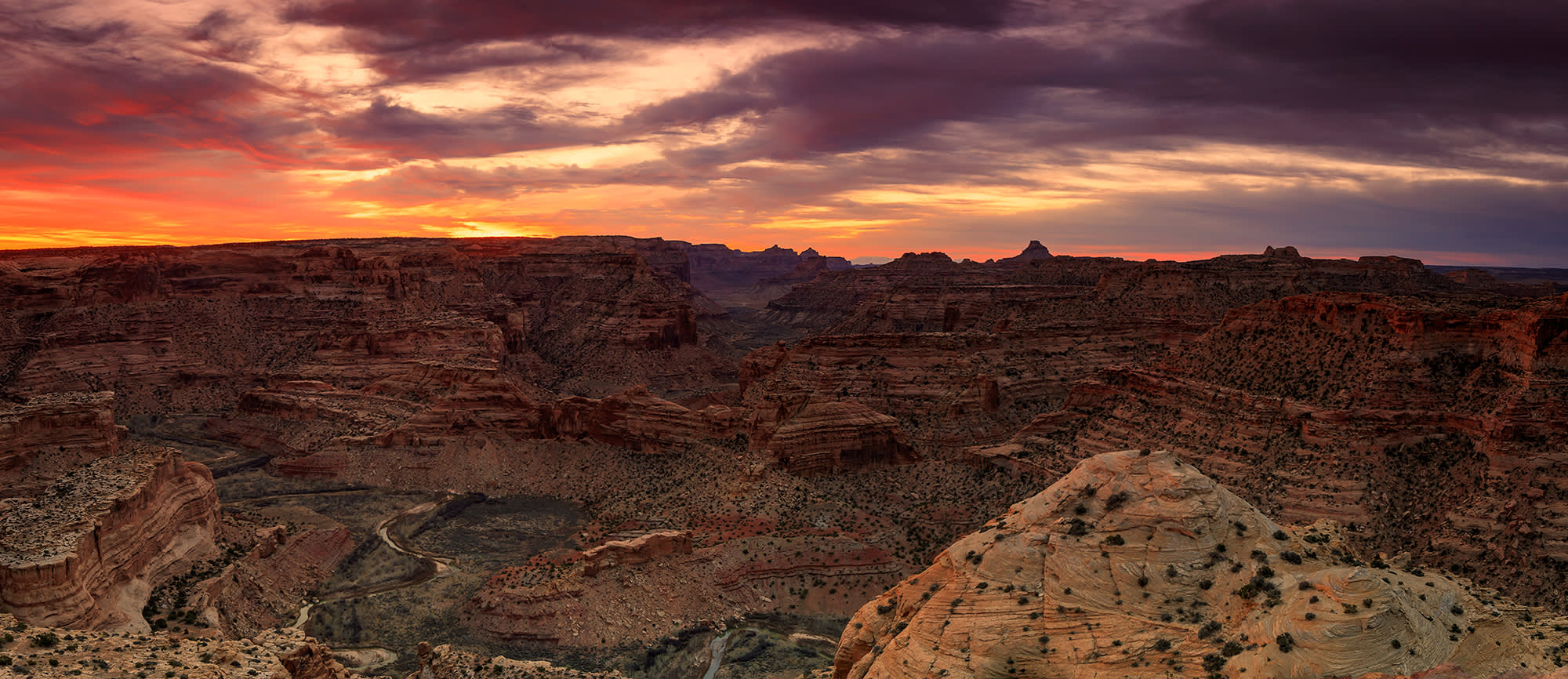
The San Rafael Swell is a 75-mile x 40-mile anticline — that’s geology speak for rock bump — a dome of sandstone, shale and limestone that was pushed up during the Paleocene Laramide Orogeny 60-40 million years ago. The Wedge, aka Little Grand Canyon, shows off the awesome valleys, canyons, gorges, mesas and buttes cut into the dome by erosion from periodic flash flooding. All that geology makes for fantastic adventuring right here in the Holocene epoch.
What you CAN do
- Bike the Good Water Rim Trail
- Hike — look around for wildlife climbing the steep canyon sides
- Climb
- ATV/OHV
- Ride horses
- Camp — campsites are available, but BYOWater
What you SHOULD do
Check out the Buckhorn Wash Pictograph Panel, petroglyphs brought to you by the ancient Barrier Canyon Culture.
Walk across the Swinging Bridge, a super-cool 160-foot-long suspension bridge built in 1937.
What NOT to do
Get too close to the edge of the overlook. The Little Grand Canyon won’t feel so little on the way down.
Be cute on Swinging Bridge.
Directions to Wedge Overlook
From Castle Dale
1. Drive east out of town on Main St/UT-10 to Green River Cutoff Rd and turn right. (1.5 miles)
2. Take Green River Cutoff Rd/UT-401 east to Buckhorn Information Center and turn right on Fullers Bottom Rd. (12.8 miles)
3. Take Fullers Bottom Rd south and take a slight left onto Wedge Rd. (0.5 miles)
4. Take Wedge Rd to Wedge Overlook. (6 miles)
From Price
1. Take UT-10 S to UT-155 S and turn left. (11.2 miles)
2. Take UT-155 S to Flat Bus Loop and turn left. (7.6 miles)
3. Take Flat Bus Loop east to Co Rd 208 and turn right. (0.3 miles)
4. Take Co Rd 208/206 to Victor Reef Rd and turn right. (3.5 miles)
5. Take Victor Reef Rd to Buffalo Rd and turn left. (2.1 miles)
6. Take Buffalo Rd/Buckhorn Draw Rd/Fullers Bottom Rd to Wedge Rd and take a slight left. (7.1 miles)
7. Take Wedge Rd to Wedge Overlook. (6 miles)
Rochester Rock Art Panel
The Rochester Panel is one of the most unusual rock art sites in the entire state of Utah — and that’s saying something. The panel features a dense concentration of figures carved by various cultures, from prehistoric groups to early white settlers (to a couple of recent idiots who don’t see the difference between their initials and 1,000-year-old Fremont artwork). Hike single-file about half a mile to reach the panel, then sit for a minute or an afternoon, imagining your predecessors meeting up, taking in the views of Muddy Creek below, replenishing themselves with their version of Clif bars and Nalgene bottles.
What you CAN do
- Bike
- Hike
- ATV/OHV
- Climb
What you SHOULD do
Take the short drive to Swasey’s Cabin. Built in 1921 by Joe, Sid, Charley and Rod (before Patrick was born).
What NOT to do
Touch the rock art. You know better. And we’ll find you.
Directions
1. Between Emery and Ferron on UT-10, find the turnoff between mile markers 16 & 17; go east on Co Rd 801.
2. Take Co Rd 801 to Co Rd 805 and turn right. (0.5 miles)
3. Follow Co Rd 805 to the trailhead. (4 miles)
Those are three of our favorites, but there lots of other things to do in the wide open middle of Utah. If you’re ready for a little breathing room, hop off the freeway and go play in the Swell.