Hovenweep National Monument
A group of five well-preserved village ruins over a 20-mile radius of mesa tops and canyons.
Noted for its solitude and undeveloped, natural character, Hovenweep National Monument was once home to more than 2,500 people in 900 A.D. In 1923, Hovenweep was proclaimed by President Warren G. Harding a unit of the national park system. The name Hovenweep is Paiute/Ute word meaning "deserted valley."
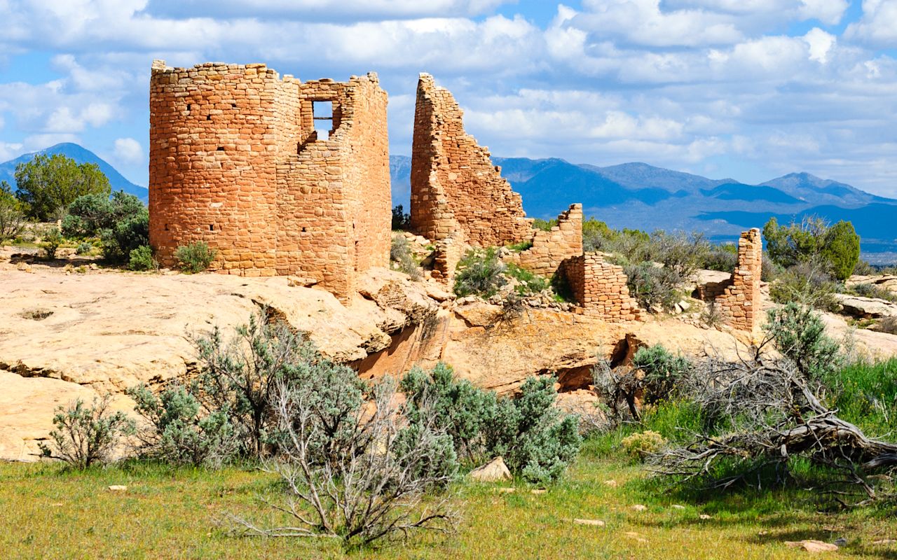
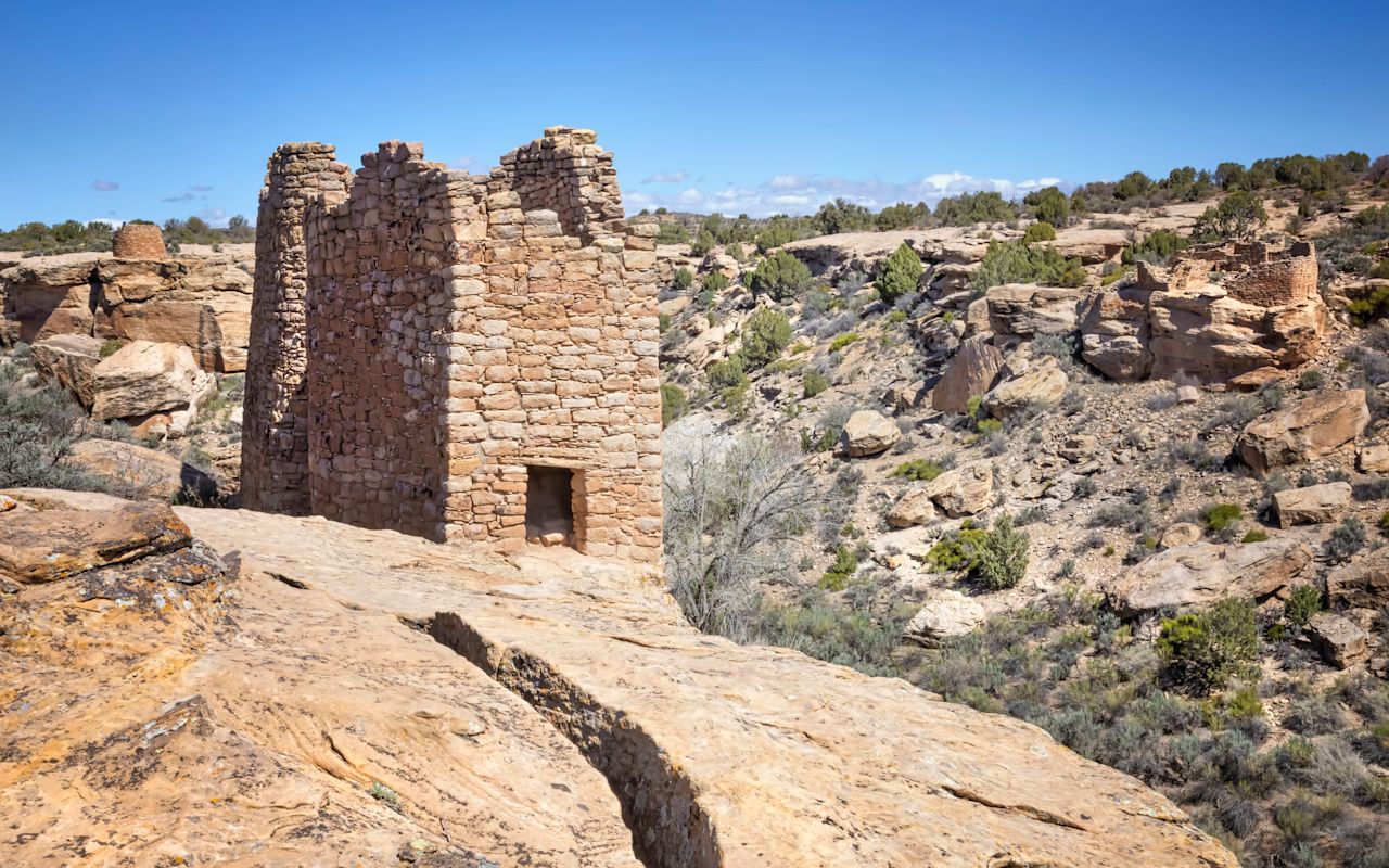
These ancient Pueblo ruins include towers that remind visitors of European castles. Straddling the Utah-Colorado border, the ruins were built about the same time as medieval fortresses.
The largest and most accessible of the six units of ruins is Square Tower, where several well-preserved structures are located. The area was home for several prehistoric farming villages. Throughout the ruins, visitors may find castles, towers, check dams (for irrigation), cliff dwellings, pueblos and houses. Petroglyphs (rock art) can also be found in the area.
Many outlying groups are available for visitation as well. They include Holly, Horseshoe, Hackberry, Cutthroat Castle and Cajon. The land surrounding the area is owned by the Navajo Nation, Bureau of Land Management, State of Utah and private landowners.
There is a system of three loop trails at the Square Tower Unit. The daily average temperature in the summer is 95 degrees Fahrenheit (35 C). Hovenweep National Monument is 20 miles north of Aneth on a gravel and paved road. There is one campground. Closest accommodations are in Bluff or Blanding.
Please stay on trails and don't enter ruins.
TRAVEL BUREAU INFORMATION
SAN JUAN COUNTY - UTAH'S CANYON COUNTRY
117 S Main St.
Monticello, UT 84535
800-574-4386
Location
Get DirectionsMonument Valley Weather
Average Temperature
Average Precipitation
Average Snowfall
Articles
View AllHappy Trails in Piute County
What do Delano Peak, the Paiute ATV trail and Butch Cassidy all have in common? Utah’s Piute County,...
8 Secrets to Sustainable Travel in Park City
Want a big adventure to Park City without a big environmental footprint? Utah.com can help you explo...
Utah County Is Festive As Heck
Fireworks, parades and corn on the cob — oh my! Utah.com has the scoop on the best festivals and fai...
Natural Bridges National Monument: A Hidden Gem, Not a Second Fiddle
An under the radar destination that should be on your radar. Learn all about Natural Bridges, Utah a...
Plan a Guys Getaway in Vernal
Planning a guys trip? Why not hit the ATV trails in Vernal, Utah with your crew? With all kinds of w...
Treat Yourself to a (San Rafael) Swell Winter
The San Rafael Swell is one of Utah’s hidden gems, and it gets even more hidden in the winter. Utah....
Plan a Triathlon of Fun in Greater Zion
Looking for things to do in St. George this fall? In addition to the IRONMAN 70.3 World Championship...
Color Me (Insert Emotion Here): Where to See Cedar City’s Feel-Good Fall Foliage
Richly hued views await you in southern Utah this autumn. Peep the changing leaves on a scenic drive...
Play Outside and See a Play Outside in Cedar City
Take a visit to Cedar City, Utah, and see why its access to both world class theater and stunning ou...
Mapping Out Utah’s Tastiest Cuisine
Getting to know the Beehive State means experiencing its sites and unique flavors. Discover both whe...
Get Your Peach Thrills in Box Elder County
Utah’s Box Elder county is a peachy paradise — part mountain range, part desert, part orchard and al...
9 Highest Peaks Across Utah
Take a peek at the tallest peaks in Utah. From Kings Peak to the Deep Creeks, Utah.com gets to the t...
Paving the Way for Everyone: All-Access Trails in Utah
From a wheelchair accessible waterfall trail to a lakeside boardwalk laden with wildflowers, these U...
Local Legends in Utah
Ever been curious about urban legends in Utah? Utah.com fills you in all things folklore with our gu...

