Willis Creek Canyon
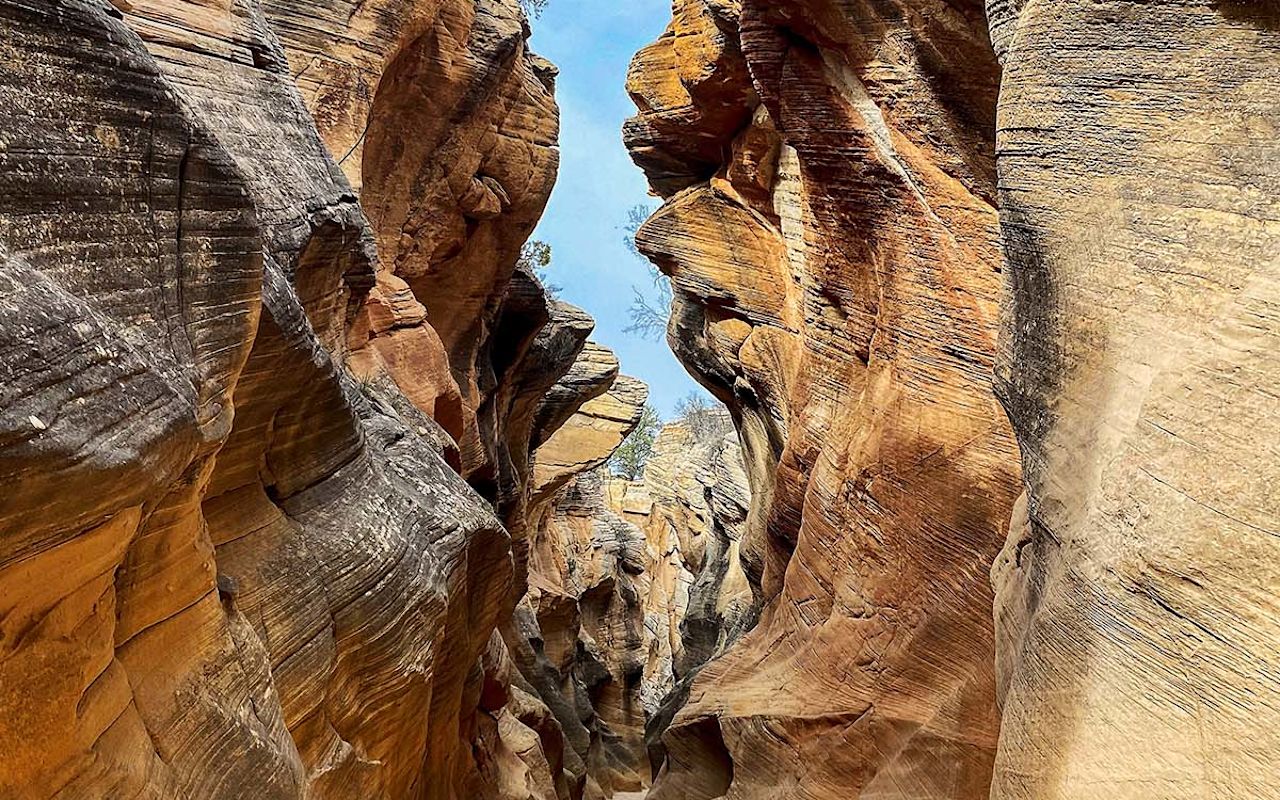
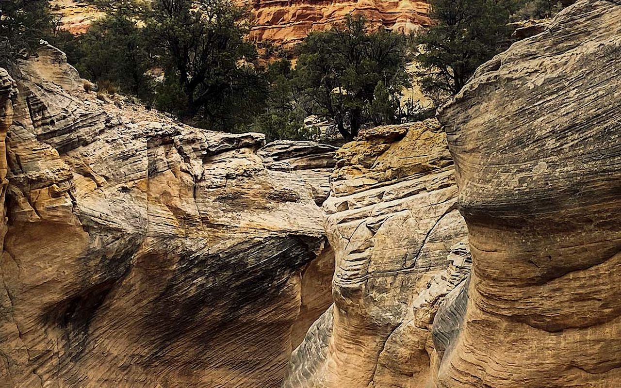
Located in Grand Staircase-Escalante National Monument, Willis Creek is a flat trail that follows a wash through a series of short slot canyons. It does not require any scrambling or technical gear and the steep, high walls never get closer than about 4 feet — making it a good intro for those who have never played Utah’s slots before. One look at the curvaceous cliffs on either side and you and you’ll know you’ve hit the outdoor jackpot. On parts of the trail, the Willis Creek narrows open up to wider spaces. Colorful rock formations are dotted with evergreens. A small arch is visible about 1.5 miles into the hike, high on the cliff ahead of you.
The trail starts across the road from the parking lot. The first slot can be entered from either the left or the right, but we recommend staying to the right. The trail wraps around some brush and offers an easier descent on dirt rather than the left side’s smooth rock.
Water may or may not be flowing depending on when you visit. The Willis Creek trail can get icy during the winter months. Spring and early summer are popular times to hike. A small waterfall is visible when the creek is flowing, but could very well be non-existent by the end of April during a drought year.
With or without those few inches of water to wade across, the mixture of sand and loose rocks makes for slightly slower hiking than a hard-packed surface. And if you’re with kids, you’ll need to factor in some extra time for the younger ones to inspect colorful rocks in the creek bed and older ones to take a few selfies along between the walls that resemble rows of noses.
Most people turn around after exiting the last canyon (which is the best one, BTW), but you can continue on the wide wash to the confluence of Sheep Creek if you choose. This adds about another 1.5 miles to the total distance.
From Highway 12 in Cannonville, head south on Kodachrome Road. Follow it for 2.7 miles until you see the wind whirligigs that look like they are straight outta the movie “Twister.” You’ll also see some inviting red picnic tables off to the right of Skutumpah Road (BLM 500). Yes, there is also a clearly marked sign. But it’s easy to miss when you’re mesmerized by the twirling metal. And no, you don’t have to worry about tornados here.
Turn on Skutumpah and take it slow. Like any dirt road, the condition of Skutumpah is dependent on the weather and the drivers before you. It may be impassible after heavy rain. Otherwise, you may encounter small sections with water runoff and large sections of washboards. There are a few steep climbs as well.
Experienced drivers should have no problem traversing the terrain in dry conditions, assuming they are in a vehicle with all-wheel or four-wheel drive. (Yes! The Honda Pilot you affectionately refer to as Maverick can make it!) But inexperienced drivers may struggle in places no matter what vehicle they are driving. Even a Jeep can slip and slide in loose rock on a steep descent without the right person behind the wheel.
Follow the road for about 4.4 miles, then go right at the split to stay on Skutumpah. Shortly thereafter you’ll cross Sheep Creek. Keep going for another 1.6 miles. The road makes a hard left. Continue for another 1.7 miles to the Willis Creek trailhead parking lot, which is on the right.
As with any slot canyon, check current flash flood watches and warnings before entering Willis Creek Canyon. Conditions can change quickly and no one can outrun a flash flood. Not even Usain Bolt.
Bring a map with you or take a screenshot of the directions. Cell service does not exist in these parts.
Sign the register located under the tree on the far side of the parking lot. This not only helps search and rescue teams find your crew in case of an emergency, but other hikers will leave comments about current hazards. And it’s fun to see where other hikers came from. New Jerseyans and Parisians may not have a lot in common, but they can bond over the beauty of Willis Creek Canyon.
Willis Creek Slot Canyon | Photo Gallery


Willis Creek Canyon
Escalante Weather
Average Temperature
Average Precipitation
Average Snowfall
Articles
View AllHappy Trails in Piute County
What do Delano Peak, the Paiute ATV trail and Butch Cassidy all have in common? Utah’s Piute County,...
8 Secrets to Sustainable Travel in Park City
Want a big adventure to Park City without a big environmental footprint? Utah.com can help you explo...
Utah County Is Festive As Heck
Fireworks, parades and corn on the cob — oh my! Utah.com has the scoop on the best festivals and fai...
Natural Bridges National Monument: A Hidden Gem, Not a Second Fiddle
An under the radar destination that should be on your radar. Learn all about Natural Bridges, Utah a...
Plan a Guys Getaway in Vernal
Planning a guys trip? Why not hit the ATV trails in Vernal, Utah with your crew? With all kinds of w...
Treat Yourself to a (San Rafael) Swell Winter
The San Rafael Swell is one of Utah’s hidden gems, and it gets even more hidden in the winter. Utah....
Plan a Triathlon of Fun in Greater Zion
Looking for things to do in St. George this fall? In addition to the IRONMAN 70.3 World Championship...
Color Me (Insert Emotion Here): Where to See Cedar City’s Feel-Good Fall Foliage
Richly hued views await you in southern Utah this autumn. Peep the changing leaves on a scenic drive...
Play Outside and See a Play Outside in Cedar City
Take a visit to Cedar City, Utah, and see why its access to both world class theater and stunning ou...
Mapping Out Utah’s Tastiest Cuisine
Getting to know the Beehive State means experiencing its sites and unique flavors. Discover both whe...
Get Your Peach Thrills in Box Elder County
Utah’s Box Elder county is a peachy paradise — part mountain range, part desert, part orchard and al...
9 Highest Peaks Across Utah
Take a peek at the tallest peaks in Utah. From Kings Peak to the Deep Creeks, Utah.com gets to the t...
Paving the Way for Everyone: All-Access Trails in Utah
From a wheelchair accessible waterfall trail to a lakeside boardwalk laden with wildflowers, these U...
Local Legends in Utah
Ever been curious about urban legends in Utah? Utah.com fills you in all things folklore with our gu...