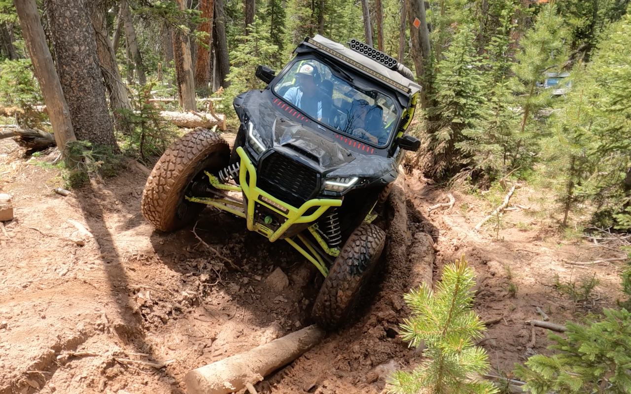
John Taylor OHV Trail
Tall trees, meadows and an old copper mine. There’s no shortage of scenery along the John Taylor OHV trail, just minutes outside of Vernal.
John Taylor OHV Trail | Photo Gallery
Check out this guided tour of the John Taylor OHV Trail!
This popular Uintah County OHV trail climbs to 10,180 feet as you meander along Taylor Mountain in Ashley National Forest. You’ll ride along Ashley Gorge, Anderson Creek, Dyer Mountain, Iron Springs and Big Bush Creek Cave.
Interactive Trail Map
Click on the icon for each of the obstacles.
Trail Overview
The John Taylor OHV trail is a 38-mile loop, with plenty of potential sightseeing stops along the way. The road is generally mild, but it gets a bit gnarly for a mile stretch littered with small boulders and logs. You’ll cross a creek and possibly some sizable puddles, as well. Extend your ride by adding the Dyer Mine Loop. Along it, you’ll come across a copper smelter and a mine that produced copper and a bit of gold.
Keep your eyes out for wildlife, lakes of lily pads, quaking aspens and lodge pole pines. There are even a few places for Insta pics, including a mostly intact — albeit rusty — Rio Grande car. Stop at Leidy Peak, one of the highest in the Uinta Mountains, for a snack break and some breathtaking views.
Trail Details
Accessible By:
- Dirtbikes
- ATVs
- Side by Sides
- UTVs
- Jeeps and 4x4s
Distance: 38 miles
Rating: Easy to difficult
Technical rating: 5/10 (one short, steep section 7/10)
Time to Ride: 6 to 8 hours
Seasonal: Late spring to fall
How to Get There
Taylor Mountain is located at 40.7202349°N, -109.6418106°W. You can stage your vehicle from the Doc’s Beach parking area, about 15 minutes north of downtown Vernal — just off 2500 W St. This is a shared lot for multiple OHV trails in Vernal, so remember to be courteous when unloading and parking.
Need to Know
Most of the trail is easy to moderate, but the extra loop portion near Dyer Mountain is rated difficult. If you’re not prepared for a fairly rough ride, best to skip that portion and stay on the main loop. Download a copy of the map so you won’t need to rely on patchy cell service to find your way.
Downloadable Maps:
Interactive Maps:
Nearby Places to Stay
Camping
Hotels
Nearby Rentals
Don’t have your own ride? Rent one.
- Cliffhanger Jeep Rentals: UTVs for two, four or six people, as well as Jeeps
- Red Cloud Rentals: two- and four-seater side-by-sides
Nearby Events
Every spring and fall, thousands of birds — red-winged blackbirds, mallards, American goldfinches, Canada geese — can be seen at the Ouray National Wildlife Refuge. Also in the fall, you’ll likely see elk and mule deer. You can take a driving tour of wetland habitat anytime of year to catch glimpses of porcupines, great horned owls and bald eagles. The refuge is about 30 miles southwest of Vernal.
FREE OHV COURSE
Utah requires all OHV operators to complete the free Utah Off-Highway Vehicle Education Course. Operators under the age of 18 shall possess a youth OHV education certificate in order to operate an OHV on public land, road or trail. Operators 18 years of age or older may operate an OHV if they possess an approved adult OHV education certificate. The once-in-a-lifetime course is expected to take less than 30 minutes to complete.
Take FREE OHV Education Course
Nearby Attractions
- Red Fleet State Park5
- Dinosaur National Monument10
- Steinaker Reservoir5
