Sundance Kid OHV Trail
Wanna live like an outlaw? Test your mettle as you scramble up and down slopes along the Sundance Kid OHV Trail, or pick your hideout near an old coal mine.
Sundance Kid OHV Trail | Photo Gallery
Watch this trail guide before you go!
There is no shortage of OHV trails in Uintah County, for both beginner and experienced riders. The Sundance Kid OHV Trail fits right in between. Aptly named for an outlaw who experienced some spine-tingling ups and downs, this ride delivers adrenaline of the legal kind.
Trail Overview
Who needs roller coasters? Get your thrill on while driving the moderate doubletrack Sundance Kid OHV Trail. You’ll climb to ridge tops, then race down into wash bottoms. Along the way, you’ll see abandoned coal mines and snow covered Marsh Peak. Take time to explore the deep canyons, then take a breather as you overlook Ashley Valley.
Interactive Trail Map
Click on the icon for each of the obstacles.
Trail Details
Timestamps from video
Sundance Kid OHV Trailhead: Explore legends of Spanish gold, mysterious symbols, and the Sundance Kid. This trail is rated a 6 on the difficulty scale.
Spanish Smelter: Local legends tell of hidden gold mines scattered around the Uintas. Could this have been a smelter?
The Deep Creek Overlook: Its high elevation makes this lookout a cool and relaxing place to have lunch and take in the scenery. On a clear day, you'll be able to see the highest point in Utah, King's Peak.
Spanish Symbols: Boulders in this area contain mysterious symbols that some say lead to hidden Spanish minds and lost gold.
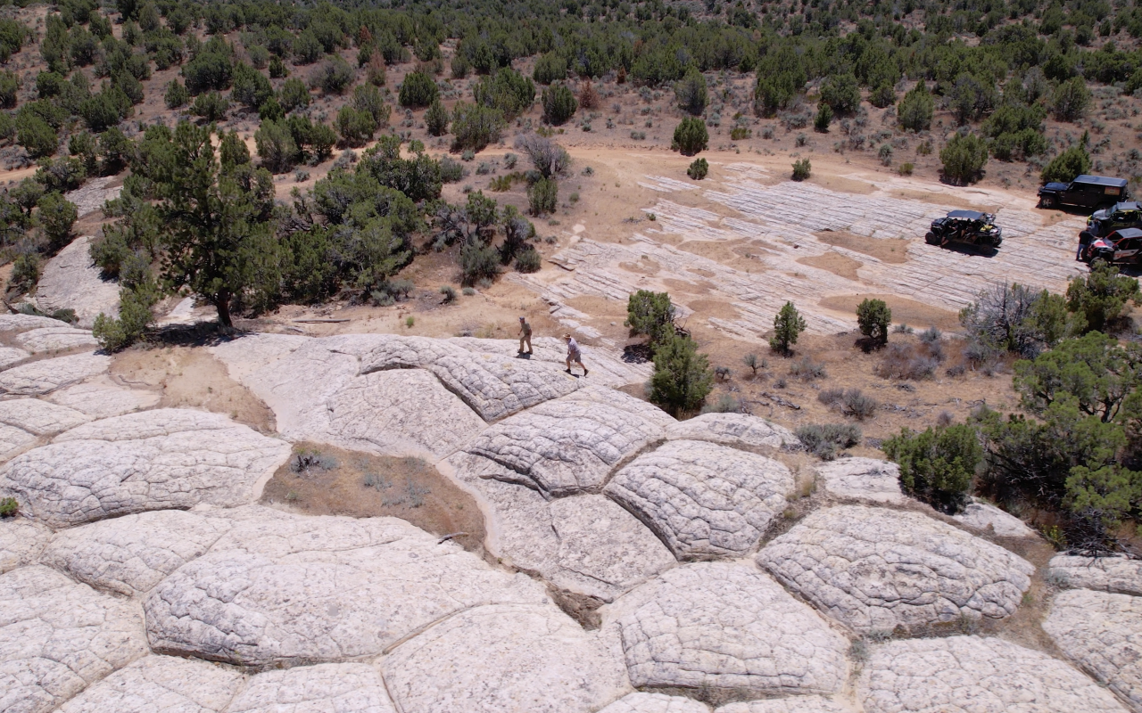
Vernal's White Top: Step out of your machine and into another planet with a rock surface that seems other-worldly
Accessible By:
- Dirtbikes
- ATVs
- Side by sides
- UTVs
- Jeeps and 4x4s
Distance: 29 miles
Rating: Moderate
Technical rating: 6/10
Time to ride: 4 to 5 hours
Seasonal: Late spring to fall
How to Get There
From Vernal, head west on State Route 121 for about 5 miles. The Coal Mine Basin Loop Trailhead, located at 40°26'15.9"N 109°38'49.5"W, serves as the staging area for the Sundance Kid OHV Trail.
Need to Know
Bring water, food and extra fuel so you can go as long as your adventuring spirit holds up. Remember to leave the area as picturesque as you found it: pack it in, pack it out.
Download maps before heading out, as cell service may be spotty.
Downloadable Maps Here:
Nearby Places to Stay
Camping
Hotels
Nearby Rentals
You can rent an OHV for the day, or just a few hours, from local vendors.
Nearby Sights
You can do a little more exploring, this time by foot, at the McConkie Ranch Petroglyphs. Located about 11 miles north of Vernal, this Utah Historic Site includes several panels of petroglyphs and pictographs. Wear hiking shoes — the 1.6-mile trail is steep in places.
Surprise! Utah was once home to dinosaurs. See some tracks at the Red Fleet Dinosaur Trackway. The moderate to strenuous hike is 3 miles roundtrip. It’s a hot one — no shade — so you might want to start early. But it’ll be worth it when you reach the dinosaur watering hole, er lake, at the top, where the tracks are conveniently located.
TRAVEL BUREAU INFORMATION
VISIT DINOSAURLAND
152 E. 100 N.
Vernal, UT 84078
800-477-5558
Click here for more OHV trails in this area.
FREE OHV COURSE
Utah requires all OHV operators to complete the free Utah Off-Highway Vehicle Education Course. Operators under the age of 18 shall possess a youth OHV education certificate in order to operate an OHV on public land, road or trail. Operators 18 years of age or older may operate an OHV if they possess an approved adult OHV education certificate. The once-in-a-lifetime course is expected to take less than 30 minutes to complete.
Take FREE OHV Education Course
Nearby Attractions
- Red Fleet State Park5
- Dinosaur National Monument10
- Steinaker Reservoir5
