Bryce Canyon Scenic Drives
Some of the majestic scenery in Bryce Canyon National Park can be seen by auto touring, no hiking needed. You can enjoy all of the park's major overlooks if you get out of your car and take leisurely strolls out to the edge of the pavement.
Utah's All American Road, Hwy 12, provides access to the Bryce Canyon Area, as it cuts across the northern part of the national park. Hwy 63 drops south from Hwy 12 and runs through the main part of the park, past the visitor center, the campgrounds and all of the park's scenic overlooks.
A convenient free shuttle operates in the park during the summer season. It runs along Hwy 63, with stops at the campgrounds, visitor center and major overlooks. Since parking is limited at the overlooks, people are encouraged to use the shuttle.
Major Points along Hwy 63 (the main Bryce Canyon Road, in order north to south).
Many visitors do not continue south past Bryce Point, but Hwy 63 continues down into the southern part of the park, to these key areas:
Swamp Canyon Trailhead:
The Swamp Canyon Loop takes hikers down into a canyon where two small creeks and a spring create a wetland with lush vegetation. Wildlife is abundant here.
Farview Point:
From this vista you can look out over parts of Bryce Canyon, and also famous features in Grand Staircase-Escalante National Monument. From north to south you can see the Aquarius Plateau (Pink Cliffs), the Kaiparowits Plateau (Grey Cliffs), Molly's Nipple (White Cliffs), and parts of the Kaibab Plateau. On most days you can easily see Navajo Mountain.
Natural Bridge:
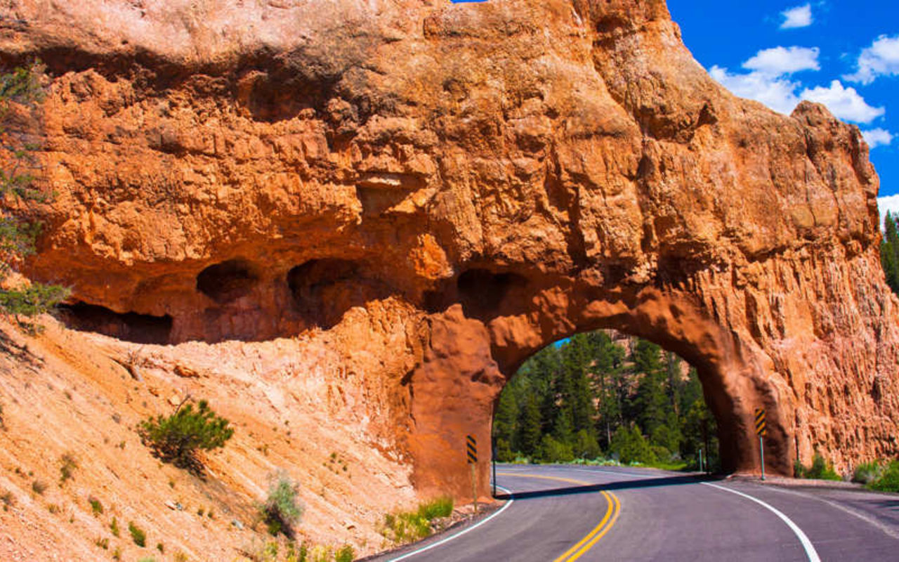
The structure called Natural Bridge is one of several natural arches found in Bryce Canyon. This one is particularly photogenic; it has been sculpted from some of the reddest rock of the Claron Formation, which is rich in iron oxide minerals. From many vantage points you can frame rich green, Ponderosa pine trees through the arch.
Agua Canyon:
This viewpoint overlooks two prominent hoodoos. The taller of the two is known as "The Hunter." To the right is a smaller hoodoo commonly referred to as the "Rabbit," or alternatively the "Backpacker."
Ponderosa Canyon:
This vista overlooks Ponderosa Canyon, so named because huge Ponderosa pine trees grow on the canyon floor. Some of these trees measure more than 5 feet in diameter and exceed heights of 150 feet. The name is a bit confusing because the viewpoint is surrounded by a forest of Blue Spruce and Douglas-fir trees.
Rainbow Point:
From this vista you can look north over much of Bryce Canyon National Park. Here you can see the snaking rim of the Pink Cliffs, and many of the park's hoodoo-filled amphitheaters.
Yovimpa Point:
This viewpoint allows visitors to look south and west over Grand Staircase-Escalante National Monument. It is one of the best spots to see the "steps" which give the Grand Staircase its name. The National Park Service provides this explanation: "The steps are named for the dominant color of rock. You are standing on the top step known as the Pink Cliffs. Directly below you are the Grey Cliffs. As you look into the distance you can see Molly's Nipple, which is part of the White Cliffs. Looking down into distant canyons near the horizon, you can just make out some red rock underneath the White Cliffs. This red rock makes up the Vermilion Cliffs. Hidden from view but directly under the towering Vermilion Cliffs are the comparatively diminutive Chocolate Cliffs. The tree-covered hills that meet the horizon belong to the Kaibab Plateau at the North Rim of the Grand Canyon."
Highway 12 Area
Hwy 12 cuts across the scenic NE portion of the of Bryce Canyon National Park. One pullout in particular allows visitors to stroll up the easy Mossy Cave Trail to get close to hoodoos set against a lush green forest. Located up the left fork of the trail is Mossy Cave itself. This is a spectacular rock overhang fed by an underground spring. In summer the cave is cool, with water dripping from hanging gardens. During winter the cave is filled with giant icicles.
Near Mossy Cave you will also find a waterfall, which lies just off the right fork of the trail. The waterfall is beautiful and can be reached via a quick and easy walk. There is also a scenic arch up near the top of a red rock formation.
Location
Get DirectionsBryce Weather
Average Temperature
Average Precipitation
Average Snowfall
Articles
View AllNaturalist Kid Scavenger Hunt in Bryce Canyon
Bryce Canyon National Park is NOT a canyon. It's really a series of amphitheaters (Haha! Perfect for...
100 Things to Do at Bryce Canyon
Find the 100 best things to do in Bryce Canyon National Park. Discover hiking, biking, ATV tours and...
3 reasons now is the best time to visit Bryce Canyon
Bryce Canyon is one of the most iconic parks in the country. Find the best time to visit Bryce Canyo...
A Long Weekend in Bryce Canyon for the Family
Use this four day Bryce Canyon itinerary to help plan your next trip to the area. Find the best plac...
Top 5 Sights in Bryce Canyon
Find the best hikes, and attractions in Bryce Canyon National Park. Check out these top five attract...
