6 Adventures off the Beaten Path in Capitol Reef National Park
Enjoy these under-the-radar outings in Utah’s most underrated park.
When you head to Capitol Reef National Park, you’re already heading a little bit off the beaten path, at least in terms of Utah national parks. In a land of geographical pairings (Zion and Bryce, Arches and Canyonlands) Capitol Reef is the lone ranger of the bunch. And just like any good solitary Western hero, it keeps its secrets close to the vest.
But Utah.com is the trusty sidekick, like Robert Redford in “Butch Cassidy and the Sundance Kid” or Johnny Depp in “The Lone Ranger” (both filmed in Utah by the way). We know where Capitol Reef keeps its hidden treasures, and we’re ready to spill the beans. And if Capitol Reef doesn’t like it, well then that just sets us up for a great sequel, doesn’t it? In the meantime, enjoy these unique outings in Utah’s most awe inspiring outlier.
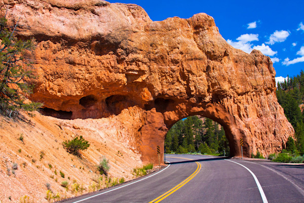
See the Difference Between an Arch and a Natural Bridge up Close
Cassidy Arch and Hickman Bridge are actually some of the most popular of Capitol Reef’s hikes. Not exactly “off the beaten path,” we hear you say. But visitors don’t often see both in the same day, or use the opportunity to learn more about the earth’s geological forces. Well, strap up those hiking boots and sharpen your pencils, because it’s time to learn about the nuances of holes in rocks.
Both natural bridges and arches are created by erosion, but a natural bridge is caused by running water. In the Utah desert, this water has long since dried up, which is why, after a 2-mile round trip hike (rated as easy to moderate) you can stand right under Hickman Bridgeand get a sense of how truly impressive it is.
You won’t have the same experience over at Cassidy Arch, unless you brought your climbing rope and harness. Steep drop offs and impassable terrain are more common with arches because of the freezing and thawing process that forms them. Water seeps into a rock’s cracks, expands when it freezes, rinses and repeats for a few thousand years and presto! It’s an arch.
The Cassidy Arch hike is a little longer and a little more challenging than Hickman Bridge (3.5-mile round trip) but most of the elevation is tackled early, with sprawling views of the surrounding hills and canyons throughout the rest of the hike. The first mile of the trail is shared with the Frying Pan trail (which you can continue on if you’d like) that traverses atop the Waterpocket Fold before splitting off for a half-mile detour to the arch.
Drive the Burr Trail Scenic Backway
The Scenic Drive through the heart of the Capitol Reef is probably the park’s main attraction, and you should absolutely make time for it. But if you’re thirsting for more adventure off the beaten path, you can find it on the Burr Trail scenic backway.
The Burr Trail travels from the town of Boulder, Utah, through Capitol Reef to the Bullfrog Marina in Glen Canyon National Recreation Area. Despite its rugged terrain, the drive is mostly paved, and the unpaved stretches are still plenty passable for most vehicles. Don’t be fooled, though — this former cattle trail is as out there as your neighbor's conspiracy theories. Make the drive and you’ll experience some of the most incredible road-accessible scenery in the state.
And when you drive the Burr Trail, you’ll see more than just Capitol Reef. In fact, there’s a whole 8.5 miles of scenery before you even reach the park’s boundaries. Inside the park, you’ll find a set of snakelike switchbacks that descend 800 feet in just a half mile. If your driver doesn’t like heights, it might be a good time to switch. And if they really don’t like heights, it might be a good time to knock them unconscious.
You’ll see all kinds of changing backcountry as you drive along this one-of-a-kind road. And you can certainly get out and stretch your legs, too. Popular side hikes include The Gulch, Upper Muley Twist and Surprise Canyon. Or, tack on more scenery with the 28-mile Wolverine Loop Road (high clearance vehicles are recommended). Even if you just do the standard drive, you’ll get views of stunning natural features like Long Canyon, the Circle Cliffs, the Waterpocket Fold and the Henry Mountains.
The Burr Trail is 67 miles long, so be sure to have your vehicle gassed up along lots of food and water. In case of emergency, notify someone of your plans to make the drive beforehand; there are plenty of spots along the drive with no cell coverage.
Have a Religious Experience in Cathedral Valley
If you’re up for more driving, head north to the Cathedral Valley region of the park. Named for its unique sandstone monoliths, or cathedrals, this remote and rugged area is a treasure trove of geologic features, and well worth the trip beyond the park’s main section.
The area gets its name from the monoliths, which look like towering cathedrals jutting out of the desert landscape. But the peace, tranquility and solitude of the area are also pretty dang cathedral-like. With nothing but the crunch of the dirt beneath your feet, you’ll imagine the echo of footsteps on the stone floors of some enormous church. If you listen closely, you can even hear an old woman shushing you.
The names of other geologic features follow suit, with places like the Walls of Jericho, Temple of the Sun and Temple of the Moon keeping things pious. You’ll also see unique features like the colorful Bentonite Hills, the shimmering Glass Mountain and the cavernous Gypsum Sinkhole.
There are a number of hikes you can take along the drive. The Jailhouse Rock and Temple Rock route is a 4.5-mile moderate rated hike with close up views of some of the larger rock formations. You can also see the Temples of the Sun and Moon from a higher vantage point by hiking the 2.5-mile Lower Cathedral Valley Overlooks hike, or see the cathedrals a little closer on the aptly named Cathedrals trail.
The drive is about 60 miles, and usually takes between six to eight hours to complete. Just like on the Burr Trail, you should bring plenty of food, water and gas for the trip. Higher clearance vehicles are preferable, although 4WD is not necessary. There is a brief river ford that’s usually not a problem, but consider asking park rangers about conditions before you make the trip.
Get Your Feet Wet With a Hike Through Sulphur Creek
Now that you’re feeling the spirit, you’re ready to walk on water. Or, more accurately, walk through water on the Sulphur Creek hike. That’s right, The Narrows, there’s a new wet and wild national park hike in Utah! Well, not so much new as “270 million years old.”
Although it’s not an official trail, Sulphur Creek is one of the best experiences the park has to offer, and rangers will be happy to update you on the changing conditions. Depending on snowmelt, rainfall and local water usage, you may be walking over a dry creek bed, hiking through a few inches of water or trudging up to your knees. In fact, it’s not uncommon for there to be a section or two where swimming is necessary. And like all desert canyon hikes, there’s a chance of flash flooding, so check the weather and don’t hike if rain is threatening.
Most people do this point-to-point hike in the downstream direction, traveling from the Sulphur Creek trailhead to the visitor center. After following a dry gulch for about a mile and a half, you’ll finally dip your toes in the babbling waters of Sulphur Creek. As the creek winds through wide open canyons and more technical slot-like sections, you’ll see all kinds of sweeping desert scenery. You’ll also be traveling through the oldest exposed rock in the park, so geology nerds — get excited.
There are a few technical sections of scrambling that might be tough for younger kids, and they should know how to swim if necessary (hiking with floaties on is no fun). But if they’re up for a 6-mile, mostly downhill hike with some adventurous sections, this will be a hike the whole family will never forget. If you can, bring two cars and leave one at the visitor center. Otherwise, the whole family will never forget the time they had to hike an extra 3 miles back to the car.
Eat a Pie at the Gifford Homestead
Another activity that’s not exactly “off the beaten path,” since these pies are world famous and snagging one in the park is a must. But how often do you get to eat a freshly cooked pie while in the middle of a national park? In the grand scheme of things, we’d say that’s a pretty one of a kind experience.
Located in the town of Fruita just outside the visitor center, the historically preserved Gifford Homestead is one of the few remnants of a once small but bustling community. Founded by Latter-day Saint pioneers, Fruita quickly became known for its fruits and vegetables (the name came second). The town was far enough up the Fremont River to avoid flooding, but still enjoyed the irrigation its waters provided. The result was what locals called “the Eden of Wayne County, Utah.”
And in this Eden, you should have no qualms about eating the fruit (apples or otherwise). Not only can you have a delicious fruit pie, but you can also pick fresh fruit of your own! The Fruita orchard is still maintained by park officials, and allows visitors to pick apricots, apples, cherries, grapes, mulberries, peaches and plums. There’s no excuse for poor pre-hike nutrition in this park.
But back to the pies. The sweet, sweet pies. They��’re sold at the Gifford House and Museum Store, which also has a number of cool homemade goods like quilts, soaps, rugs, candles and toys, along with books and other museum staples. The pies are of the smaller hand pie variety, so you can split one before a hike or reward yourself with one (or two or three) of your own afterwards. Although they usually sell out, so load up early for your post-hike treats.
There’s even a picnic area designated for pie enjoyment. You can technically eat other foods there too, but you’ll probably be haunted by a Gifford ghost or two.
Go Stargazing
Plenty of people have been known to watch the sun rise over the Waterpocket Fold or stick around to watch it disappear behind the Henry Mountains. But fewer people come back after dark to enjoy one of the best shows the park has to offer — the night’s sky.
Capitol Reef is a certified International Dark Sky Park, one of a whopping 24 such places in the state. In fact, Utah has the highest concentration of dark sky areas in the entire world. With unique geologic features set against the starry sky and more solitude than some of its more crowded counterparts, Capitol Reef is as good a place as any to take it all in.
If you don’t want to make the drive back into the park after dark, there are a number of places where you can camp out. The popular Fruita campground requires a reservation, but there are primitive campsites in the rugged Cathedral Valley and Cedar Mesa areas that are first come, first serve. These remote areas serve up a stargazing experience that’s hard to match. You’ll not only get to see an incredibly clear night sky, but also experience the stillness of the country the way Fruita pioneers and earlier native inhabitants must have.
Seeing some of the darkest skies in the world, wading through a canyon and enjoying rugged backcountry road trips with a steady supply of pie through it all — we’d say that’s pretty unbeaten as far as paths go, right? And that’s just the tip of the cathedral. There’s plenty to do in Capitol Reef and the surrounding areas in Wayne County. Start planning your trip today.
Categories:
Destinations:
You May Also Like
View All5 Utah National Parks in 5 Days
Learn how to visit all five national parks in Utah with this national park road trip. See Zion, Arch...
9 Reasons Your Next Glamping Trip Should Be in Capitol Reef
Glamping is one of the best ways to enjoy Capitol Reef. Check out some of the reasons you need to tr...
Fact: Utah's Skies Are the Darkest
Utah is home to nine different dark sky parks. Read on to find the best stargazing spots and nightti...