Bryce Canyon Travel Guide
Learn how to do Bryce Canyon National Park by experience level, or how much time you have.
Sometimes referred to as a “forest of stone,” the beautiful Bryce Canyon hoodoos (red rock pillars carved by ice and frost that look almost exactly like Martians) stand frozen in time, delicate yet nearly eternal, like the facial expressions of Goldie Hawn. Bryce Canyon’s geological wonders far exceed their hype. Just seeing them is something to behold, but you’re gonna wanna do more than just look.
So let’s get down to it: Here are the hikes, pull-offs and panoramas we’ve hand selected for Bryce Canyon, organized by how much golden daylight you have to burn.
Here are a few “G-rated” hikes for you:
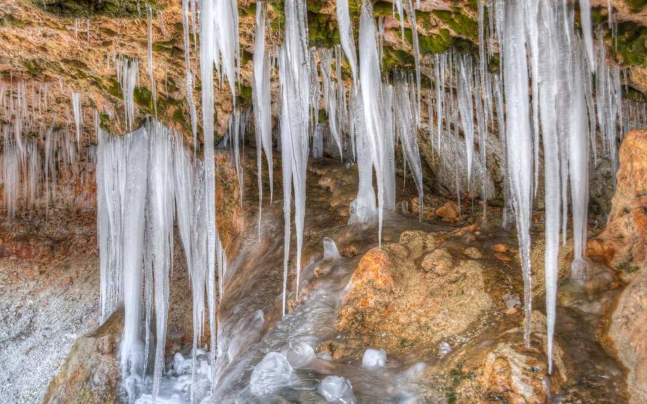
Mossy Cave: Follow a stream past moss, ice and rock. 1.0 miles roundtrip.
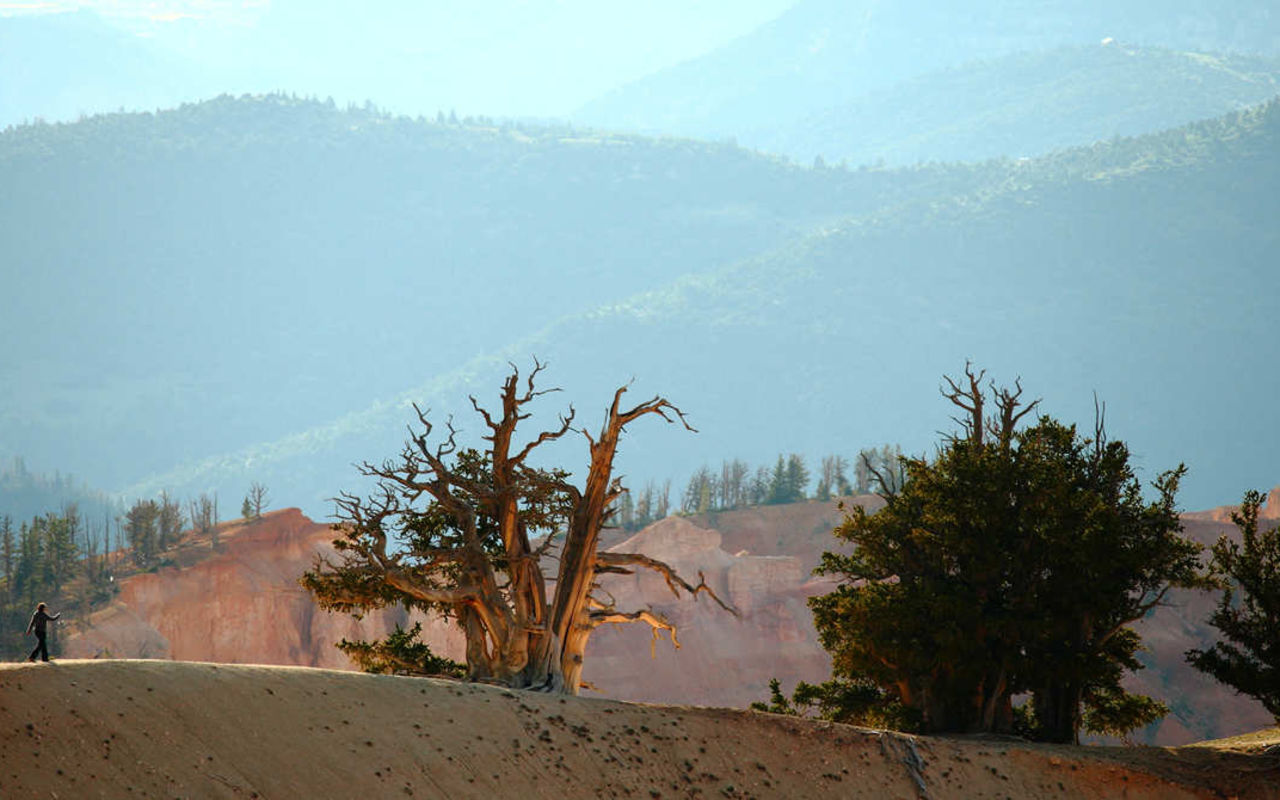
Bristlecone Pine Loop: A casual walk to a 1,600-year-old view. Not a bad place to settle down, prairie dogs. 1.0 miles roundtrip.
Rim Trail: The paved section between Sunrise Point and Sunset Point is flat and easy. The rest gets moderate with some climbing. 9.4 miles roundtrip.
Here are a few “PG-13-rated” hikes for you:
Navajo Loop: Five trails for one. Bring a park map and get un-irretrievably lost. 1.3 miles roundtrip.
Riggs Spring Loop: Long hike with longer views. 8.8 miles roundtrip.
Queens Garden Loop: Short, steep and to the point. 1.8 miles roundtrip.
Here are a few “R-rated” hikes for you:
Fairyland Loop: A texture-rich trek. 8.3 miles.
Peekaboo Loop: Start with a view and make your way down. 5.5 miles.
Guide to Bryce Canyon | Photo Gallery


Bryce Canyon National Park
How much time do you have?
If you have HALF A DAY…
Navajo Loop. Kill 4–5 birds with one stone when you hike Bryce’s most popular trail. It’ll take you past Queens Garden, Wall Street, Thors Hammer, and Sunset Point. You’ll descend 800 feet and pop out on the other side. The entire trek looks so much like Mars, you might find Matt Damon in a dark corner, growing potatoes by dubious means while he waits to be multibillion-dollar rescued.
Inspiration Point. Want that perfect Instagram shot? Take your pick from one of three levels offered at Inspiration Point. Drive right up and behold the best views of the amphitheater. #nofilter.
Queens Garden Loop. Short, steep and to the point, Queens Garden will take you from Sunrise Point, down some 800 feet, and leave you to explore the haunting ocean-like amphitheaters below. It’s like deep-sea diving, except you still get to breathe and no one has to watch you wrestle yourself into a wetsuit.
If you have A FULL DAY…
Pair the half-day locations with these:
Fairyland Loop Trail. Don’t let the name deceive you. This hike is too much for delicate, glitter-sweating mythical creatures. Unless they’re like the Navy Seals of fairies. Start at Fairyland Point and dip down 900 feet. You’ll trek past pink-red-orange-white hoodoos and canyon walls and end at the massive, beautiful base of Boat Mesa. It’s one of the tougher hikes in Bryce so bring water, a snack and an extra layer of grit.
Natural Bridge. Its name is not only bland, but also inaccurate — it’s actually a natural arch. Natural Bridge itself, however is just the opposite: compelling and incontrovertible. It’s a viewpoint, not a trail, but don’t let the convenience make you think it’s not worth pulling over.
If you have THREE DAYS…
You’ve got time for all of the above and a little (or a lot?) of this:
Riggs Spring Loop. Take your time and wind through this scenic trail filled with red rock, hoodoos and a surprisingly lush forest in the middle of the desert. It’s long — 8.8 miles. Starting at the Rainbow Point parking area, the trail descends 2,200 feet through Corral Hollow to Riggs Spring, then loops back up through Yovimpa Pass to where it started.
Peekaboo Loop. Finally, a place where horse people and normal people (just kidding, horse people!) can come together in harmony. An equestrian trail hikers are also welcome to use, Peekaboo Loop starts up at Bryce Point, a beautiful beginning to an excellent hike. You’ll descend 1,000 feet, cross through the Navajo Loop Trail and come back up a gnarly climb that will make you earn your lunch, be it PB&J or a bag of oats.
Bristlecone Loop. At the southwest end of Bryce Canyon, off of the Rainbow Point parking lot, is the opening for Bristlecone Loop. It’s a well-marked forest trail that stays above the canyon. Pretty easy, pretty short, pretty great views. Toward the end, grab a selfie with your arm around a bristlecone pine that predates your mom, indoor plumbing and the fall of the Roman Empire.
Hidden Gem: Mossy Cave Trail
Stick it to the man and head north from the park, then east on Highway 12 to access the underrated, unsung Mossy Cave. It’s an easy hike with a lovely destination, away from the main Bryce Canyon thoroughfare. Follow a gentle stream that will take you to a natural grotto, a shelter cave and, depending on the season, either long ghostly icicles or lichen and moss.
Want more?
Get the inside scoop on where to go, what to do, and where to stay — and tap into all the pre-trip planning info you’ll need to book the adventure of a lifetime.
Sign up for our emails.
All you want is li'l Utah adventure. All the kids want is non-stop entertainment. With our trusty grab-bag of Utah-themed coloring pages, mazes, and dot-to-dots, your kids will experience the joys of true, analog fun. And you? You’ll get some cold hard quiet.
Download our free kids activity book.
Location
Get DirectionsBryce Weather
Average Temperature
Average Precipitation
Average Snowfall
Articles
View AllNaturalist Kid Scavenger Hunt in Bryce Canyon
Bryce Canyon National Park is NOT a canyon. It's really a series of amphitheaters (Haha! Perfect for...
100 Things to Do at Bryce Canyon
Find the 100 best things to do in Bryce Canyon National Park. Discover hiking, biking, ATV tours and...
3 reasons now is the best time to visit Bryce Canyon
Bryce Canyon is one of the most iconic parks in the country. Find the best time to visit Bryce Canyo...
A Long Weekend in Bryce Canyon for the Family
Use this four day Bryce Canyon itinerary to help plan your next trip to the area. Find the best plac...
Top 5 Sights in Bryce Canyon
Find the best hikes, and attractions in Bryce Canyon National Park. Check out these top five attract...